
Search by Postcode
Map of the best Hotels near the B48 7HA Postcode in Lilley Green Road, Alvechurch
We have searched high and low to find the best hotels near the B48 7HA postcode in the historic county of Worcestershire.
The B48 7HA postcode is situated in Alvechurch. We have found hotels nearby.
Use our easy to use hotel map or comprehensive accommodation listings to find the right B48 7HA hotel for you.
| Zoom Level | Latitude | Longitude |
| 6 | 53.521968 | -2.164306 |
Hotel Deals for B48 7HA Postcode in Lilley Green Road, Alvechurch
The Nearest Hospitals to B48 7HA Postcode in Lilley Green Road, Alvechurch
| Hospital Name | Operator | Distance Km | Distance Mi. |
|---|---|---|---|
| West Heath Hospital | West Heath Hospital, Rednal Road, Birmingham, West Midlands, B38 8HR | 6.45 | 4.01 |
| Alexandra Hospital | Woodrow Drive, Redditch, Worcestershire, B98 7UB | 7.53 | 4.68 |
| Royal Orthopaedic Hospital | The Woodlands, Bristol Road South, Birmingham, West Midlands, B31 2AP | 8.94 | 5.56 |
| Selly Oak Hospital | Raddlebarn Road, Selly Oak, Birmingham, B29 6JD | 10.10 | 6.27 |
Cheap Hotels near the B48 7HA Postcode in Alvechurch
The 10 nearest Budget hotels to the B48 7HA Postcode offering economy accommodation
| Budget Hotel Name | Distance |
|---|---|
| 1:
Premier Inn Redditch North A441 | 5.00 km (3.11 Miles) |
| 2:
Travelodge Birmingham Maypole | 6.76 km (4.20 Miles) |
| 3:
Premier Inn Redditch West A448 | 9.33 km (5.80 Miles) |
| 4:
Premier Inn Birmingham South Longbridge Station | 10.14 km (6.30 Miles) |
| 5:
Premier Inn Birmingham South Hall Green | 11.37 km (7.06 Miles) |
The Nearest Airports to B48 7HA Postcode in Lilley Green Road, Alvechurch
| Airport Name | Distance Km | Distance Mi. |
|---|---|---|
| Birmingham International Airport | 16.69 | 10.37 |
| Coventry Airport | 29.39 | 18.26 |
| Gloucestershire Airport | 53.37 | 33.16 |
The Nearest Stations to B48 7HA Postcode in Lilley Green Road, Alvechurch
| Station Name | Operator | Distance Km | Distance Mi. |
|---|---|---|---|
| Earlswood (West Midlands) | London Midland Trains | 3.74 | 2.32 |
| Alvechurch | London Midland Trains | 4.14 | 2.57 |
| Wood End | London Midland Trains | 4.27 | 2.65 |
Places to Stay near the B48 7HA Postcode
Church Hill Farm
| Church Hill Farm |
| Distance in Km 2.86 |
 |
| View entry for Church Hill Farm on Bed Map |
Abbey Hotel Golf & Spa
| Abbey Hotel Golf & Spa |
| Distance in Km 3.89 |
 |
| View entry for Abbey Hotel Golf & Spa on Bed Map |
Oak tree stables cottage
| Oak tree stables cottage |
| Distance in Km 4.20 |
 |
| View entry for Oak tree stables cottage on Bed Map |
The Limes Country Lodge Hotel
| The Limes Country Lodge Hotel |
| Distance in Km 4.36 |
 |
| View entry for The Limes Country Lodge Hotel on Bed Map |
Meadow Farm Redditch by Marstons Inns
| Meadow Farm Redditch by Marstons Inns |
| Distance in Km 4.55 |
 |
| View entry for Meadow Farm Redditch by Marstons Inns on Bed Map |
Little Rushbrook Cottages
| Little Rushbrook Cottages |
| Distance in Km 5.10 |
 |
| View entry for Little Rushbrook Cottages on Bed Map |
OYO Blue Inn
| OYO Blue Inn |
| Distance in Km 5.40 |
 |
| View entry for OYO Blue Inn on Bed Map |
Beoley Lodge
| Beoley Lodge |
| Distance in Km 5.41 |
 |
| View entry for Beoley Lodge on Bed Map |
The Orangery Restaurant & Rooms
| The Orangery Restaurant & Rooms |
| Distance in Km 5.60 |
 |
| View entry for The Orangery Restaurant & Rooms on Bed Map |
Holiday Inn Express Birmingham Redditch
| Holiday Inn Express Birmingham Redditch |
| Distance in Km 6.08 |
 |
| View entry for Holiday Inn Express Birmingham Redditch on Bed Map |
Homestay in Birmingham Sleeps 8 - Free Parking & Wifi
| Homestay in Birmingham Sleeps 8 - Free Parking & Wifi |
| Distance in Km 6.30 |
 |
| View entry for Homestay in Birmingham Sleeps 8 - Free Parking & Wifi on Bed Map |
The Westmead Hotel
| The Westmead Hotel |
| Distance in Km 6.63 |
 |
| View entry for The Westmead Hotel on Bed Map |
De Regency Style Hotel
| De Regency Style Hotel |
| Distance in Km 6.65 |
 |
| View entry for De Regency Style Hotel on Bed Map |
Travelodge Birmingham Maypole
| Travelodge Birmingham Maypole |
| Distance in Km 6.76 |
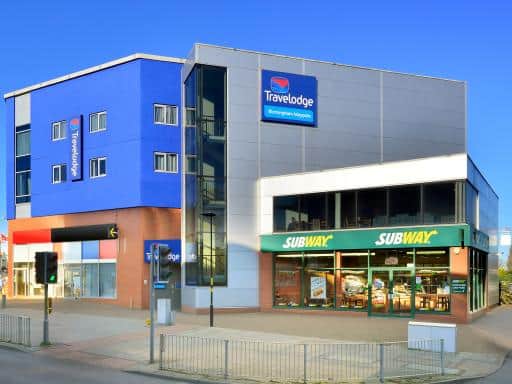 |
| View entry for Travelodge Birmingham Maypole on Bed Map |
Home from home, close to Redditch hospital & transport links
| Home from home, close to Redditch hospital & transport links |
| Distance in Km 6.88 |
 |
| View entry for Home from home, close to Redditch hospital & transport links on Bed Map |
zenit
| zenit |
| Distance in Km 6.91 |
 |
| View entry for zenit on Bed Map |
The Southcrest Manor Hotel Redditch
| The Southcrest Manor Hotel Redditch |
| Distance in Km 7.04 |
 |
| View entry for The Southcrest Manor Hotel Redditch on Bed Map |
Monyhull Hotel - near City centre Kingsheath NIA NEC BHX
| Monyhull Hotel - near City centre Kingsheath NIA NEC BHX |
| Distance in Km 7.12 |
 |
| View entry for Monyhull Hotel - near City centre Kingsheath NIA NEC BHX on Bed Map |
Is a Hotel Missing?
Let us know the Name, Address and Postcode and we’ll add it to our listings.
Contact Us