
Search by Postcode
Map of the best Hotels near the CV23 9HJ Postcode in Long Lawford
We have searched high and low to find the best hotels near the CV23 9HJ postcode in the historic county of Warwickshire.
The CV23 9HJ postcode is situated in Long Lawford. We have found hotels nearby.
Use our easy to use hotel map or comprehensive accommodation listings to find the right CV23 9HJ hotel for you.
| Zoom Level | Latitude | Longitude |
| 6 | 53.521968 | -2.164306 |
Hotel Deals for CV23 9HJ Postcode in Long Lawford
The Nearest Hospitals to CV23 9HJ Postcode in Long Lawford
| Hospital Name | Operator | Distance Km | Distance Mi. |
|---|---|---|---|
| Hospital Of St Cross | Barby Rd, Rugby, Warwickshire, CV22 5PX | 6.57 | 4.08 |
| BMI The Meriden Hospital | University Hospital Site, Clifford Bridge Road, Coventry, West Midlands, CV2 2LQ | 9.67 | 6.01 |
| University Hospital (Coventry) | Clifford Bridge Road, Coventry, Warwickshire, CV2 2DX | 9.72 | 6.04 |
| Caludon Centre | Clifford Bridge Road, , CV2 2TE | 9.89 | 6.15 |
Cheap Hotels near the CV23 9HJ Postcode in Long Lawford
The 10 nearest Budget hotels to the CV23 9HJ Postcode offering economy accommodation
| Budget Hotel Name | Distance |
|---|---|
| 1:
Travelodge Rugby Dunchurch | 1.79 km (1.11 Miles) |
| 2:
Premier Inn Coventry East Binley A46 | 9.92 km (6.16 Miles) |
| 3:
Premier Inn Coventry East Ansty | 10.16 km (6.31 Miles) |
| 4:
Travelodge Coventry Binley | 11.51 km (7.15 Miles) |
| 5:
Premier Inn Rugby North Newbold | 11.67 km (7.25 Miles) |
The Nearest Airports to CV23 9HJ Postcode in Long Lawford
| Airport Name | Distance Km | Distance Mi. |
|---|---|---|
| Coventry Airport | 8.38 | 5.21 |
| Birmingham International Airport | 27.89 | 17.33 |
| East Midlands Airport | 52.65 | 32.72 |
Places to Stay near the CV23 9HJ Postcode
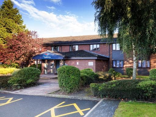
Travelodge Rugby Dunchurch
| Travelodge Rugby Dunchurch |
| Distance in Km 1.79 |
 |
| View entry for Travelodge Rugby Dunchurch on Bed Map |
Draycote Hotel And Whitefields Golf Course
| Draycote Hotel And Whitefields Golf Course |
| Distance in Km 2.94 |
 |
| View entry for Draycote Hotel And Whitefields Golf Course on Bed Map |
Village period cottage
| Village period cottage |
| Distance in Km 5.39 |
 |
| View entry for Village period cottage on Bed Map |
Golden Lion Hotel
| Golden Lion Hotel |
| Distance in Km 7.62 |
 |
| View entry for Golden Lion Hotel on Bed Map |
Dunchurch Park Hotel
| Dunchurch Park Hotel |
| Distance in Km 8.09 |
 |
| View entry for Dunchurch Park Hotel on Bed Map |
Coombe Abbey Hotel
| Coombe Abbey Hotel |
| Distance in Km 9.06 |
 |
| View entry for Coombe Abbey Hotel on Bed Map |
Bourton House
| Bourton House |
| Distance in Km 9.59 |
 |
| View entry for Bourton House on Bed Map |
White Hall Farm
| White Hall Farm |
| Distance in Km 9.68 |
 |
| View entry for White Hall Farm on Bed Map |
Cocked Hat by Greene King Inns
| Cocked Hat by Greene King Inns |
| Distance in Km 9.98 |
 |
| View entry for Cocked Hat by Greene King Inns on Bed Map |
Sparrow Hall Barn
| Sparrow Hall Barn |
| Distance in Km 10.17 |
 |
| View entry for Sparrow Hall Barn on Bed Map |
The Rugby Hotel
| The Rugby Hotel |
| Distance in Km 10.24 |
 |
| View entry for The Rugby Hotel on Bed Map |
Little Church Street
| Little Church Street |
| Distance in Km 10.42 |
 |
| View entry for Little Church Street on Bed Map |
Magna
| Magna |
| Distance in Km 10.50 |
 |
| View entry for Magna on Bed Map |
Blackberry Barn
| Blackberry Barn |
| Distance in Km 10.53 |
 |
| View entry for Blackberry Barn on Bed Map |
Church Court Apartments
| Church Court Apartments |
| Distance in Km 10.65 |
 |
| View entry for Church Court Apartments on Bed Map |
King’s Landing
| King’s Landing |
| Distance in Km 10.96 |
 |
| View entry for King’s Landing on Bed Map |
CV225AA Ground-Floor Flat Near Rugby School Self Check-in
| CV225AA Ground-Floor Flat Near Rugby School Self Check-in |
| Distance in Km 10.98 |
 |
| View entry for CV225AA Ground-Floor Flat Near Rugby School Self Check-in on Bed Map |
The Farmhouse
| The Farmhouse |
| Distance in Km 11.00 |
 |
| View entry for The Farmhouse on Bed Map |
Is a Hotel Missing?
Let us know the Name, Address and Postcode and we’ll add it to our listings.
Contact Us