
Search by Postcode
Map of the best Hotels near the CV23 9RX Postcode in Birdingbury Road, Long Lawford
We have searched high and low to find the best hotels near the CV23 9RX postcode in the historic county of Warwickshire.
The CV23 9RX postcode is situated in Long Lawford. We have found hotels nearby.
Use our easy to use hotel map or comprehensive accommodation listings to find the right CV23 9RX hotel for you.
| Zoom Level | Latitude | Longitude |
| 6 | 53.521968 | -2.164306 |
Hotel Deals for CV23 9RX Postcode in Birdingbury Road, Long Lawford
The Nearest Hospitals to CV23 9RX Postcode in Birdingbury Road, Long Lawford
| Hospital Name | Operator | Distance Km | Distance Mi. |
|---|---|---|---|
| Hospital Of St Cross | Barby Rd, Rugby, Warwickshire, CV22 5PX | 10.36 | 6.44 |
| Nuffield Health, Warwickshire Hospital | The Chase, Leamington Spa, Warwickshire, CV32 6RW | 10.77 | 6.69 |
| Royal Leamington Spa Rehabilitation Hospital | Heathcote Lane, Warwick, Warwickshire, CV34 6SR | 11.65 | 7.24 |
| University Hospital (Coventry) | Clifford Bridge Road, Coventry, Warwickshire, CV2 2DX | 12.73 | 7.91 |
Cheap Hotels near the CV23 9RX Postcode in Long Lawford
The 10 nearest Budget hotels to the CV23 9RX Postcode offering economy accommodation
| Budget Hotel Name | Distance |
|---|---|
| 1:
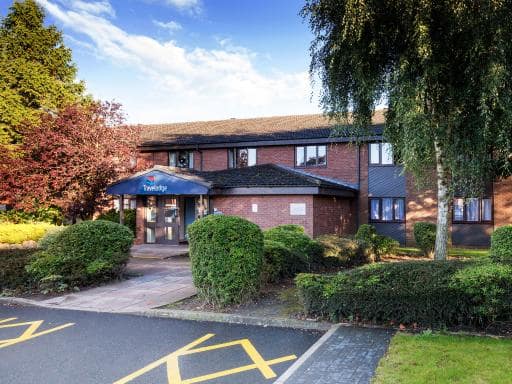
Travelodge Rugby Dunchurch | 6.02 km (3.74 Miles) |
| 2:
Premier Inn Coventry East Binley A46 | 10.70 km (6.65 Miles) |
| 3:
Travelodge Coventry Binley | 12.00 km (7.46 Miles) |
| 4:
Premier Inn Coventry East Ansty | 13.49 km (8.38 Miles) |
| 5:
Premier Inn Coventry - M6 J2 | 14.49 km (9.00 Miles) |
The Nearest Airports to CV23 9RX Postcode in Birdingbury Road, Long Lawford
| Airport Name | Distance Km | Distance Mi. |
|---|---|---|
| Coventry Airport | 8.66 | 5.38 |
| Birmingham International Airport | 28.21 | 17.53 |
| London Oxford Airport | 53.53 | 33.26 |
The Nearest Stations to CV23 9RX Postcode in Birdingbury Road, Long Lawford
| Station Name | Operator | Distance Km | Distance Mi. |
|---|---|---|---|
| Leamington Spa | Chiltern Railways | 10.75 | 6.68 |
| Rugby | Virgin Trains (West Coast) | 11.74 | 7.30 |
| Coventry | Virgin Trains (West Coast) | 13.13 | 8.16 |
Places to Stay near the CV23 9RX Postcode
White Hall Farm
| White Hall Farm |
| Distance in Km 3.99 |
 |
| View entry for White Hall Farm on Bed Map |
Blackberry Barn
| Blackberry Barn |
| Distance in Km 4.84 |
 |
| View entry for Blackberry Barn on Bed Map |
Travelodge Rugby Dunchurch
| Travelodge Rugby Dunchurch |
| Distance in Km 6.02 |
 |
| View entry for Travelodge Rugby Dunchurch on Bed Map |
Pendicke Cottage, Southam
| Pendicke Cottage, Southam |
| Distance in Km 6.69 |
 |
| View entry for Pendicke Cottage, Southam on Bed Map |
Modern terraced cottage in the heart of Southam
| Modern terraced cottage in the heart of Southam |
| Distance in Km 6.70 |
 |
| View entry for Modern terraced cottage in the heart of Southam on Bed Map |
Inspire Homes - Joe's Cottage
| Inspire Homes - Joe's Cottage |
| Distance in Km 6.70 |
 |
| View entry for Inspire Homes - Joe's Cottage on Bed Map |
One Abbey Lane
| One Abbey Lane |
| Distance in Km 6.87 |
 |
| View entry for One Abbey Lane on Bed Map |
Draycote Hotel And Whitefields Golf Course
| Draycote Hotel And Whitefields Golf Course |
| Distance in Km 6.87 |
 |
| View entry for Draycote Hotel And Whitefields Golf Course on Bed Map |
Marstons Croft
| Marstons Croft |
| Distance in Km 7.13 |
 |
| View entry for Marstons Croft on Bed Map |
Village period cottage
| Village period cottage |
| Distance in Km 7.31 |
 |
| View entry for Village period cottage on Bed Map |
The Sunshine Annex at Lower Fields Farm
| The Sunshine Annex at Lower Fields Farm |
| Distance in Km 8.29 |
 |
| View entry for The Sunshine Annex at Lower Fields Farm on Bed Map |
The Forge
| The Forge |
| Distance in Km 8.81 |
 |
| View entry for The Forge on Bed Map |
The Caravan at Lower Fields Farm
| The Caravan at Lower Fields Farm |
| Distance in Km 8.97 |
 |
| View entry for The Caravan at Lower Fields Farm on Bed Map |
Lower Fields Farm
| Lower Fields Farm |
| Distance in Km 8.98 |
 |
| View entry for Lower Fields Farm on Bed Map |
The spinney
| The spinney |
| Distance in Km 9.50 |
 |
| View entry for The spinney on Bed Map |
Wigrams Canalside Cottage
| Wigrams Canalside Cottage |
| Distance in Km 9.79 |
 |
| View entry for Wigrams Canalside Cottage on Bed Map |
Owl Cottage, Southam
| Owl Cottage, Southam |
| Distance in Km 10.21 |
 |
| View entry for Owl Cottage, Southam on Bed Map |
Cocked Hat by Greene King Inns
| Cocked Hat by Greene King Inns |
| Distance in Km 10.63 |
 |
| View entry for Cocked Hat by Greene King Inns on Bed Map |
Is a Hotel Missing?
Let us know the Name, Address and Postcode and we’ll add it to our listings.
Contact Us