
Search by Postcode
Map of the best Hotels near the DN22 8NX Postcode in Low Street, Ranskill
We have searched high and low to find the best hotels near the DN22 8NX postcode in the historic county of Nottinghamshire.
The DN22 8NX postcode is situated in Ranskill. We have found hotels nearby.
Use our easy to use hotel map or comprehensive accommodation listings to find the right DN22 8NX hotel for you.
| Zoom Level | Latitude | Longitude |
| 6 | 53.521968 | -2.164306 |
Hotel Deals for DN22 8NX Postcode in Low Street, Ranskill
The Nearest Hospitals to DN22 8NX Postcode in Low Street, Ranskill
| Hospital Name | Operator | Distance Km | Distance Mi. |
|---|---|---|---|
| Retford Hospital | North Road, Retford, Nottinghamshire, DN22 7XF | 6.79 | 4.22 |
| Bassetlaw Hospital | Kilton Hill, Blyth Road, Worksop, Nottinghamshire, S81 0BD | 8.97 | 5.58 |
| John Coupland Hospital | Ropery Road, Gainsborough, Lincolnshire, DN21 2TJ | 15.66 | 9.73 |
| Tickhill Road Hospital | Rotherham Doncaster and South Humber NHS Foundation Trust, Weston Road, Doncaster, DN4 8QL | 16.66 | 10.35 |
Cheap Hotels near the DN22 8NX Postcode in Ranskill
The 10 nearest Budget hotels to the DN22 8NX Postcode offering economy accommodation
| Budget Hotel Name | Distance |
|---|---|
| 1:
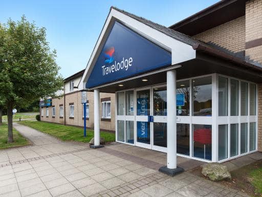
Travelodge Blyth A1M | 5.49 km (3.41 Miles) |
| 2:
Travelodge Worksop | 15.99 km (9.94 Miles) |
| 3:
Travelodge Retford Markham Moor | 16.42 km (10.20 Miles) |
| 4:
Travelodge Doncaster Lakeside | 18.09 km (11.24 Miles) |
| 5:
Premier Inn Doncaster Central East | 18.36 km (11.41 Miles) |
The Nearest Airports to DN22 8NX Postcode in Low Street, Ranskill
| Airport Name | Distance Km | Distance Mi. |
|---|---|---|
| Robin Hood Doncaster Sheffield Airport | 11.87 | 7.38 |
| Humberside Airport | 49.69 | 30.87 |
| East Midlands Airport | 64.36 | 39.99 |
Places to Stay near the DN22 8NX Postcode
Ye Olde Bell Hotel & Spa
| Ye Olde Bell Hotel & Spa |
| Distance in Km 2.38 |
 |
| View entry for Ye Olde Bell Hotel & Spa on Bed Map |
Beech Farm Barn Annex
| Beech Farm Barn Annex |
| Distance in Km 2.97 |
 |
| View entry for Beech Farm Barn Annex on Bed Map |
Cow Slip - UK13138
| Cow Slip - UK13138 |
| Distance in Km 3.10 |
 |
| View entry for Cow Slip - UK13138 on Bed Map |
Olivia - UK13137
| Olivia - UK13137 |
| Distance in Km 3.10 |
 |
| View entry for Olivia - UK13137 on Bed Map |
Saddlers Barn Country Retreat
| Saddlers Barn Country Retreat |
| Distance in Km 4.36 |
 |
| View entry for Saddlers Barn Country Retreat on Bed Map |
The Angel Inn (Blyth)
| The Angel Inn (Blyth) |
| Distance in Km 5.42 |
 |
| View entry for The Angel Inn (Blyth) on Bed Map |
Travelodge Blyth A1M
| Travelodge Blyth A1M |
| Distance in Km 5.49 |
 |
| View entry for Travelodge Blyth A1M on Bed Map |
The Crown Hotel Bawtry-Doncaster
| The Crown Hotel Bawtry-Doncaster |
| Distance in Km 6.33 |
 |
| View entry for The Crown Hotel Bawtry-Doncaster on Bed Map |
Bawtrys Bar & Brasserie
| Bawtrys Bar & Brasserie |
| Distance in Km 6.37 |
 |
| View entry for Bawtrys Bar & Brasserie on Bed Map |
Bawtrys bar & brasserie
| Bawtrys bar & brasserie |
| Distance in Km 6.37 |
 |
| View entry for Bawtrys bar & brasserie on Bed Map |
Orchard View Cottage
| Orchard View Cottage |
| Distance in Km 7.30 |
 |
| View entry for Orchard View Cottage on Bed Map |
The Barns Country Guesthouse
| The Barns Country Guesthouse |
| Distance in Km 7.39 |
 |
| View entry for The Barns Country Guesthouse on Bed Map |
Home Farm & Lodge
| Home Farm & Lodge |
| Distance in Km 7.85 |
 |
| View entry for Home Farm & Lodge on Bed Map |
Hallcroft Fishery And Caravan Park
| Hallcroft Fishery And Caravan Park |
| Distance in Km 7.99 |
 |
| View entry for Hallcroft Fishery And Caravan Park on Bed Map |
Best Western Plus West Retford Hotel
| Best Western Plus West Retford Hotel |
| Distance in Km 8.73 |
 |
| View entry for Best Western Plus West Retford Hotel on Bed Map |
Crescent Mount
| Crescent Mount |
| Distance in Km 9.07 |
 |
| View entry for Crescent Mount on Bed Map |
STATION LODGE - REAR FLAT WITH GARDEN
| STATION LODGE - REAR FLAT WITH GARDEN |
| Distance in Km 9.30 |
 |
| View entry for STATION LODGE - REAR FLAT WITH GARDEN on Bed Map |
Ground Floor. X1 Bed Flat - Near A1, Town Centre of Retford, Public Transport
| Ground Floor. X1 Bed Flat - Near A1, Town Centre of Retford, Public Transport |
| Distance in Km 9.49 |
 |
| View entry for Ground Floor. X1 Bed Flat - Near A1, Town Centre of Retford, Public Transport on Bed Map |
Is a Hotel Missing?
Let us know the Name, Address and Postcode and we’ll add it to our listings.
Contact Us