
Search by Postcode
Map of the best Hotels near the LS15 8PX Postcode in Selby Road, Manston - Leeds
We have searched high and low to find the best hotels near the LS15 8PX postcode in the historic county of West Yorkshire.
The LS15 8PX postcode is situated in Manston - Leeds. We have found hotels nearby.
Use our easy to use hotel map or comprehensive accommodation listings to find the right LS15 8PX hotel for you.
| Zoom Level | Latitude | Longitude |
| 6 | 53.521968 | -2.164306 |
Hotel Deals for LS15 8PX Postcode in Selby Road, Manston - Leeds
The Nearest Hospitals to LS15 8PX Postcode in Selby Road, Manston - Leeds
| Hospital Name | Operator | Distance Km | Distance Mi. |
|---|---|---|---|
| Seacroft Hospital | York Road, Leeds, West Yorkshire, LS14 6UH | 2.58 | 1.60 |
| St James's Hospital | Beckett Street, Beckett Street, Leeds, West Yorkshire, LS9 7TF | 5.60 | 3.48 |
| Becklin Centre | Alma Street, Leeds, West Yorkshire, LS9 7BE | 5.90 | 3.67 |
| Spire Methley Park Hospital | Methley Lane, Methley, Leeds, West Yorkshire, LS26 9HG | 6.24 | 3.88 |
Cheap Hotels near the LS15 8PX Postcode in Manston - Leeds
The 10 nearest Budget hotels to the LS15 8PX Postcode offering economy accommodation
| Budget Hotel Name | Distance |
|---|---|
| 1:
Travelodge Leeds Colton | 0.73 km (0.45 Miles) |
| 2:
Premier Inn Leeds East | 1.62 km (1.01 Miles) |
| 3:
Travelodge Leeds Central Vicar Lane | 11.58 km (7.20 Miles) |
| 4:
easyHotel Leeds | 11.90 km (7.39 Miles) |
| 5:
easyHotel Leeds | 11.90 km (7.39 Miles) |
The Nearest Airports to LS15 8PX Postcode in Selby Road, Manston - Leeds
| Airport Name | Distance Km | Distance Mi. |
|---|---|---|
| Leeds Bradford International Airport | 16.77 | 10.42 |
| Robin Hood Doncaster Sheffield Airport | 44.86 | 27.87 |
| Manchester Airport | 73.38 | 45.59 |
The Nearest Stations to LS15 8PX Postcode in Selby Road, Manston - Leeds
| Station Name | Operator | Distance Km | Distance Mi. |
|---|---|---|---|
| Cross Gates | Northern | 1.42 | 0.88 |
| Garforth | Northern | 3.51 | 2.18 |
| East Garforth | Northern | 4.31 | 2.68 |
Places to Stay near the LS15 8PX Postcode
Travelodge Leeds Colton
| Travelodge Leeds Colton |
| Distance in Km 0.73 |
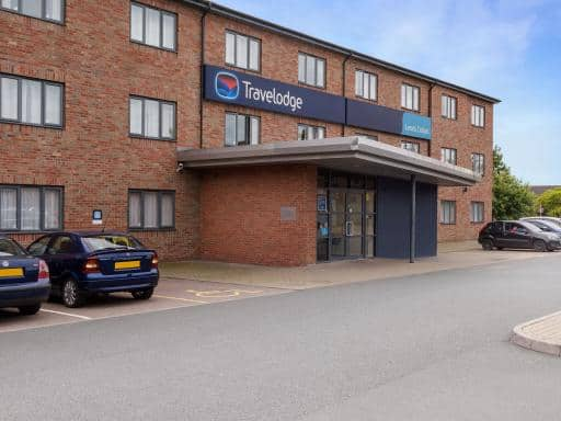 |
| View entry for Travelodge Leeds Colton on Bed Map |
Thorpe Park Hotel and Spa
| Thorpe Park Hotel and Spa |
| Distance in Km 0.97 |
 |
| View entry for Thorpe Park Hotel and Spa on Bed Map |
Holiday Inn Leeds Garforth
| Holiday Inn Leeds Garforth |
| Distance in Km 3.63 |
 |
| View entry for Holiday Inn Leeds Garforth on Bed Map |
Britannia Hotel Leeds
| Britannia Hotel Leeds |
| Distance in Km 3.63 |
 |
| View entry for Britannia Hotel Leeds on Bed Map |
Bridge Farm Hotel
| Bridge Farm Hotel |
| Distance in Km 3.95 |
 |
| View entry for Bridge Farm Hotel on Bed Map |
Ramada by Wyndham Leeds East
| Ramada by Wyndham Leeds East |
| Distance in Km 4.67 |
 |
| View entry for Ramada by Wyndham Leeds East on Bed Map |
The Midland Hotel
| The Midland Hotel |
| Distance in Km 4.79 |
 |
| View entry for The Midland Hotel on Bed Map |
New Masons Arms
| New Masons Arms |
| Distance in Km 5.66 |
 |
| View entry for New Masons Arms on Bed Map |
Large 2 ensuite bedroom flat with lovely views
| Large 2 ensuite bedroom flat with lovely views |
| Distance in Km 5.77 |
 |
| View entry for Large 2 ensuite bedroom flat with lovely views on Bed Map |
Holiday Inn Express Leeds-East
| Holiday Inn Express Leeds-East |
| Distance in Km 5.90 |
 |
| View entry for Holiday Inn Express Leeds-East on Bed Map |
OAKWOOD HOUSE Detached home in North Leeds
| OAKWOOD HOUSE Detached home in North Leeds |
| Distance in Km 5.94 |
 |
| View entry for OAKWOOD HOUSE Detached home in North Leeds on Bed Map |
Oulton Hall
| Oulton Hall |
| Distance in Km 6.18 |
 |
| View entry for Oulton Hall on Bed Map |
Beech House
| Beech House |
| Distance in Km 6.35 |
 |
| View entry for Beech House on Bed Map |
The Old Post Box
| The Old Post Box |
| Distance in Km 6.43 |
 |
| View entry for The Old Post Box on Bed Map |
The Oaks
| The Oaks |
| Distance in Km 7.10 |
 |
| View entry for The Oaks on Bed Map |
Ash Oaklands Close
| Ash Oaklands Close |
| Distance in Km 7.11 |
 |
| View entry for Ash Oaklands Close on Bed Map |
Mini Hotel Bohemia
| Mini Hotel Bohemia |
| Distance in Km 7.35 |
 |
| View entry for Mini Hotel Bohemia on Bed Map |
Shaftesbury Apartment
| Shaftesbury Apartment |
| Distance in Km 7.57 |
 |
| View entry for Shaftesbury Apartment on Bed Map |
Is a Hotel Missing?
Let us know the Name, Address and Postcode and we’ll add it to our listings.
Contact Us