
Search by Postcode
Map of the best Hotels near the NE15 8NX Postcode in Greenfinch Way, Lemington - Newcastle Upon Tyne
We have searched high and low to find the best hotels near the NE15 8NX postcode in the historic county of Tyne and Wear.
The NE15 8NX postcode is situated in Lemington - Newcastle Upon Tyne. We have found hotels nearby.
Use our easy to use hotel map or comprehensive accommodation listings to find the right NE15 8NX hotel for you.
| Zoom Level | Latitude | Longitude |
| 6 | 53.521968 | -2.164306 |
Hotel Deals for NE15 8NX Postcode in Greenfinch Way, Lemington - Newcastle Upon Tyne
The Nearest Hospitals to NE15 8NX Postcode in Greenfinch Way, Lemington - Newcastle Upon Tyne
| Hospital Name | Operator | Distance Km | Distance Mi. |
|---|---|---|---|
| Dunston Hill Hospital | Dunston Hill, Gateshead, Tyne and Wear, NE11 9QT | 4.24 | 2.64 |
| Diabetes Centre | Newcastle General Hospital, Westgate Road, Newcastle Upon Tyne, Tyne and Wear, NE4 6BE | 4.25 | 2.64 |
| Newcastle Dental Hospital | Richardson Road, Newcastle Upon Tyne, Tyne and Wear, NE2 4AZ | 5.66 | 3.52 |
| The Royal Victoria Infirmary | Queen Victoria Road, New Victoria Wing, Newcastle Upon Tyne, NE1 4LP | 5.84 | 3.63 |
Cheap Hotels near the NE15 8NX Postcode in Lemington - Newcastle Upon Tyne
The 10 nearest Budget hotels to the NE15 8NX Postcode offering economy accommodation
| Budget Hotel Name | Distance |
|---|---|
| 1:
Premier Inn Newcastle Metro Centre | 2.84 km (1.76 Miles) |
| 2:
Travelodge Gateshead | 3.00 km (1.86 Miles) |
| 3:
Travelodge Newcastle Airport | 6.01 km (3.73 Miles) |
| 4:
Premier Inn Newcastle Airport | 7.15 km (4.44 Miles) |
| 5:
Premier Inn Newcastle South | 9.59 km (5.96 Miles) |
The Nearest Airports to NE15 8NX Postcode in Greenfinch Way, Lemington - Newcastle Upon Tyne
| Airport Name | Distance Km | Distance Mi. |
|---|---|---|
| Newcastle International Airport | 7.29 | 4.53 |
| Durham Tees Valley Airport | 54.16 | 33.65 |
| Leeds Bradford International Airport | 122.58 | 76.16 |
The Nearest Stations to NE15 8NX Postcode in Greenfinch Way, Lemington - Newcastle Upon Tyne
| Station Name | Operator | Distance Km | Distance Mi. |
|---|---|---|---|
| Blaydon | Northern | 0.67 | 0.42 |
| MetroCentre | Northern | 3.14 | 1.95 |
| Dunston | Northern | 4.92 | 3.06 |
Places to Stay near the NE15 8NX Postcode
SPACIOUS HOMELY HOUSE In A QUIET STREET, PERFECT FOR FAMILIES AND LARGER GROUPS
| SPACIOUS HOMELY HOUSE In A QUIET STREET, PERFECT FOR FAMILIES AND LARGER GROUPS |
| Distance in Km 0.51 |
 |
| View entry for SPACIOUS HOMELY HOUSE In A QUIET STREET, PERFECT FOR FAMILIES AND LARGER GROUPS on Bed Map |
Michelangelos - Rooms, Restaurant & Bar
| Michelangelos - Rooms, Restaurant & Bar |
| Distance in Km 1.98 |
 |
| View entry for Michelangelos - Rooms, Restaurant & Bar on Bed Map |
3 Bed Flat Perfect for Contractor & Professional Stay
| 3 Bed Flat Perfect for Contractor & Professional Stay |
| Distance in Km 2.15 |
 |
| View entry for 3 Bed Flat Perfect for Contractor & Professional Stay on Bed Map |
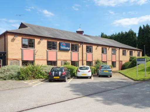
Travelodge Gateshead
| Travelodge Gateshead |
| Distance in Km 3.00 |
 |
| View entry for Travelodge Gateshead on Bed Map |
Holiday Inn Express Newcastle Metro Centre
| Holiday Inn Express Newcastle Metro Centre |
| Distance in Km 3.23 |
 |
| View entry for Holiday Inn Express Newcastle Metro Centre on Bed Map |
Hedgefield House
| Hedgefield House |
| Distance in Km 3.23 |
 |
| View entry for Hedgefield House on Bed Map |
Hoppers Cottage Guest House
| Hoppers Cottage Guest House |
| Distance in Km 3.34 |
 |
| View entry for Hoppers Cottage Guest House on Bed Map |
Newcastle Gateshead Marriott Hotel Metrocentre
| Newcastle Gateshead Marriott Hotel Metrocentre |
| Distance in Km 3.86 |
 |
| View entry for Newcastle Gateshead Marriott Hotel Metrocentre on Bed Map |
Benwell Village Mews
| Benwell Village Mews |
| Distance in Km 4.11 |
 |
| View entry for Benwell Village Mews on Bed Map |
The Keelman and Big Lamp Brewery
| The Keelman and Big Lamp Brewery |
| Distance in Km 4.25 |
 |
| View entry for The Keelman and Big Lamp Brewery on Bed Map |
Runhead Forge
| Runhead Forge |
| Distance in Km 4.56 |
 |
| View entry for Runhead Forge on Bed Map |
Spacious stylish flat
| Spacious stylish flat |
| Distance in Km 4.83 |
 |
| View entry for Spacious stylish flat on Bed Map |
Georgious Modern 4 bedroom house - Free Parking and Netflix by WHA for Contractors, Relocation, Business Travelers
| Georgious Modern 4 bedroom house - Free Parking and Netflix by WHA for Contractors, Relocation, Business Travelers |
| Distance in Km 4.84 |
 |
| View entry for Georgious Modern 4 bedroom house - Free Parking and Netflix by WHA for Contractors, Relocation, Business Travelers on Bed Map |
OYO The Benwell Apartments
| OYO The Benwell Apartments |
| Distance in Km 5.77 |
 |
| View entry for OYO The Benwell Apartments on Bed Map |
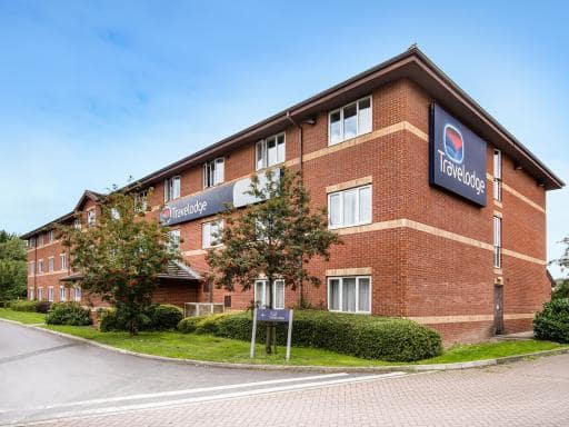
Travelodge Newcastle Airport
| Travelodge Newcastle Airport |
| Distance in Km 6.01 |
 |
| View entry for Travelodge Newcastle Airport on Bed Map |
Novotel Newcastle Airport
| Novotel Newcastle Airport |
| Distance in Km 6.14 |
 |
| View entry for Novotel Newcastle Airport on Bed Map |
City Bridge Townhouse 4
| City Bridge Townhouse 4 |
| Distance in Km 6.14 |
 |
| View entry for City Bridge Townhouse 4 on Bed Map |
SERVICED HOUSE IN NEWCASTLE, CONTRACTORS, GROUPS, CLOSE To MOTORWAY ACCESS
| SERVICED HOUSE IN NEWCASTLE, CONTRACTORS, GROUPS, CLOSE To MOTORWAY ACCESS |
| Distance in Km 6.24 |
 |
| View entry for SERVICED HOUSE IN NEWCASTLE, CONTRACTORS, GROUPS, CLOSE To MOTORWAY ACCESS on Bed Map |
Is a Hotel Missing?
Let us know the Name, Address and Postcode and we’ll add it to our listings.
Contact Us