
Search by Postcode
Map of the best Hotels near the NG22 0RR Postcode in Top Street, Tuxford
We have searched high and low to find the best hotels near the NG22 0RR postcode in the historic county of Nottinghamshire.
The NG22 0RR postcode is situated in Tuxford. We have found hotels nearby.
Use our easy to use hotel map or comprehensive accommodation listings to find the right NG22 0RR hotel for you.
| Zoom Level | Latitude | Longitude |
| 6 | 53.521968 | -2.164306 |
Hotel Deals for NG22 0RR Postcode in Top Street, Tuxford
The Nearest Hospitals to NG22 0RR Postcode in Top Street, Tuxford
| Hospital Name | Operator | Distance Km | Distance Mi. |
|---|---|---|---|
| Retford Hospital | North Road, Retford, Nottinghamshire, DN22 7XF | 7.45 | 4.63 |
| Bassetlaw Hospital | Kilton Hill, Blyth Road, Worksop, Nottinghamshire, S81 0BD | 15.14 | 9.41 |
| John Coupland Hospital | Ropery Road, Gainsborough, Lincolnshire, DN21 2TJ | 17.90 | 11.12 |
| The Manor Hospital | Central Drive, Shirebrook, Mansfield, Nottinghamshire, NG20 8BA | 22.42 | 13.93 |
Cheap Hotels near the NG22 0RR Postcode in Tuxford
The 10 nearest Budget hotels to the NG22 0RR Postcode offering economy accommodation
| Budget Hotel Name | Distance |
|---|---|
| 1:
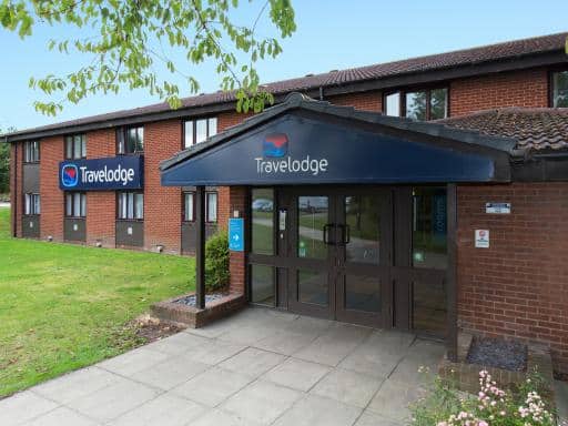
Travelodge Retford Markham Moor | 3.20 km (1.99 Miles) |
| 2:
Travelodge Newark North Muskham | 18.04 km (11.21 Miles) |
| 3:
Travelodge Gainsborough | 20.40 km (12.68 Miles) |
| 4:
Travelodge Blyth A1M | 22.44 km (13.94 Miles) |
| 5:
Premier Inn Newark | 22.73 km (14.12 Miles) |
The Nearest Airports to NG22 0RR Postcode in Top Street, Tuxford
| Airport Name | Distance Km | Distance Mi. |
|---|---|---|
| Robin Hood Doncaster Sheffield Airport | 25.00 | 15.53 |
| Humberside Airport | 50.70 | 31.50 |
| East Midlands Airport | 56.63 | 35.19 |
Places to Stay near the NG22 0RR Postcode
The Granary, Newark
| The Granary, Newark |
| Distance in Km 0.01 |
 |
| View entry for The Granary, Newark on Bed Map |
Ginny's Barn
| Ginny's Barn |
| Distance in Km 0.01 |
 |
| View entry for Ginny's Barn on Bed Map |
Travelodge Retford Markham Moor
| Travelodge Retford Markham Moor |
| Distance in Km 3.20 |
 |
| View entry for Travelodge Retford Markham Moor on Bed Map |
No 20
| No 20 |
| Distance in Km 3.63 |
 |
| View entry for No 20 on Bed Map |
The Fountain
| The Fountain |
| Distance in Km 3.96 |
 |
| View entry for The Fountain on Bed Map |
Robinson Apartment at West Drayton Farm
| Robinson Apartment at West Drayton Farm |
| Distance in Km 4.38 |
 |
| View entry for Robinson Apartment at West Drayton Farm on Bed Map |
Bradford Apartment at West Drayton Farm
| Bradford Apartment at West Drayton Farm |
| Distance in Km 4.38 |
 |
| View entry for Bradford Apartment at West Drayton Farm on Bed Map |
Carver Apartment at West Drayton Farm
| Carver Apartment at West Drayton Farm |
| Distance in Km 4.41 |
 |
| View entry for Carver Apartment at West Drayton Farm on Bed Map |
The Carver Apartment
| The Carver Apartment |
| Distance in Km 4.42 |
 |
| View entry for The Carver Apartment on Bed Map |
The Robinson Apartment
| The Robinson Apartment |
| Distance in Km 4.42 |
 |
| View entry for The Robinson Apartment on Bed Map |
The Bradford Apartment
| The Bradford Apartment |
| Distance in Km 4.42 |
 |
| View entry for The Bradford Apartment on Bed Map |
The Allerton Apartment at West Drayton Farm
| The Allerton Apartment at West Drayton Farm |
| Distance in Km 4.42 |
 |
| View entry for The Allerton Apartment at West Drayton Farm on Bed Map |
The Allerton Apartment
| The Allerton Apartment |
| Distance in Km 4.47 |
 |
| View entry for The Allerton Apartment on Bed Map |
The Farmhouse
| The Farmhouse |
| Distance in Km 4.47 |
 |
| View entry for The Farmhouse on Bed Map |
The Elms Hotel
| The Elms Hotel |
| Distance in Km 6.65 |
 |
| View entry for The Elms Hotel on Bed Map |
The Lawns Guest House
| The Lawns Guest House |
| Distance in Km 6.75 |
 |
| View entry for The Lawns Guest House on Bed Map |
JOE'S PLACE
| JOE'S PLACE |
| Distance in Km 6.84 |
 |
| View entry for JOE'S PLACE on Bed Map |
Joe’s Place
| Joe’s Place |
| Distance in Km 6.92 |
 |
| View entry for Joe’s Place on Bed Map |
Is a Hotel Missing?
Let us know the Name, Address and Postcode and we’ll add it to our listings.
Contact Us