
Search by Postcode
Map of the best Hotels near the NN16 8FX Postcode in Rothwell Road, Kettering
We have searched high and low to find the best hotels near the NN16 8FX postcode in the historic county of Northamptonshire.
The NN16 8FX postcode is situated in Kettering. We have found hotels nearby.
Use our easy to use hotel map or comprehensive accommodation listings to find the right NN16 8FX hotel for you.
| Zoom Level | Latitude | Longitude |
| 6 | 53.521968 | -2.164306 |
Hotel Deals for NN16 8FX Postcode in Rothwell Road, Kettering
The Nearest Hospitals to NN16 8FX Postcode in Rothwell Road, Kettering
| Hospital Name | Operator | Distance Km | Distance Mi. |
|---|---|---|---|
| Kettering General Hospital | Kettering General Hospital, Rothwell Road, Kettering, Northamptonshire, NN16 8UZ | 0.89 | 0.56 |
| Woodland Hospital | Woodland Hospital, Rothwell Road, Kettering, Northamptonshire, NN16 8XF | 1.45 | 0.90 |
| St Mary's Hospital | 77 London Road, Kettering, Northamptonshire, NN15 7PW | 2.45 | 1.52 |
| Isebrook Hospital | Irthlingborough Road, Wellingborough, Northamptonshire, NN8 1LP | 13.04 | 8.10 |
Cheap Hotels near the NN16 8FX Postcode in Kettering
The 10 nearest Budget hotels to the NN16 8FX Postcode offering economy accommodation
| Budget Hotel Name | Distance |
|---|---|
| 1:
Premier Inn Kettering | 0.29 km (0.18 Miles) |
| 2:
Travelodge Kettering | 3.72 km (2.31 Miles) |
| 3:
Premier Inn Corby | 5.94 km (3.69 Miles) |
| 4:
Premier Inn Wellingborough | 14.81 km (9.20 Miles) |
| 5:
Travelodge Northampton Round Spinney | 17.72 km (11.01 Miles) |
The Nearest Airports to NN16 8FX Postcode in Rothwell Road, Kettering
| Airport Name | Distance Km | Distance Mi. |
|---|---|---|
| Coventry Airport | 49.30 | 30.63 |
| East Midlands Airport | 60.80 | 37.78 |
| London Luton Airport | 63.95 | 39.74 |
The Nearest Stations to NN16 8FX Postcode in Rothwell Road, Kettering
| Station Name | Operator | Distance Km | Distance Mi. |
|---|---|---|---|
| Kettering | East Midlands Trains | 2.03 | 1.26 |
| Corby | East Midlands Trains | 9.98 | 6.20 |
| Wellingborough | East Midlands Trains | 12.58 | 7.82 |
Places to Stay near the NN16 8FX Postcode
The Rothwell Guest Apartment
| The Rothwell Guest Apartment |
| Distance in Km 1.40 |
 |
| View entry for The Rothwell Guest Apartment on Bed Map |
Kettering Leisure Holiday Home
| Kettering Leisure Holiday Home |
| Distance in Km 1.92 |
 |
| View entry for Kettering Leisure Holiday Home on Bed Map |
Dalby Lodge
| Dalby Lodge |
| Distance in Km 2.19 |
 |
| View entry for Dalby Lodge on Bed Map |
Buccleuch Apartment
| Buccleuch Apartment |
| Distance in Km 2.32 |
 |
| View entry for Buccleuch Apartment on Bed Map |
Cosy Corner House
| Cosy Corner House |
| Distance in Km 2.59 |
 |
| View entry for Cosy Corner House on Bed Map |
Lahnstein Court
| Lahnstein Court |
| Distance in Km 2.78 |
 |
| View entry for Lahnstein Court on Bed Map |
Denim Dreams Apartment
| Denim Dreams Apartment |
| Distance in Km 2.78 |
 |
| View entry for Denim Dreams Apartment on Bed Map |
Royal Hotel Kettering (Peymans)
| Royal Hotel Kettering (Peymans) |
| Distance in Km 2.80 |
 |
| View entry for Royal Hotel Kettering (Peymans) on Bed Map |
Eskdaill Place Apartment
| Eskdaill Place Apartment |
| Distance in Km 2.99 |
 |
| View entry for Eskdaill Place Apartment on Bed Map |
Holiday Inn Express Kettering Corby
| Holiday Inn Express Kettering Corby |
| Distance in Km 3.12 |
 |
| View entry for Holiday Inn Express Kettering Corby on Bed Map |
Manhattan Penthouse
| Manhattan Penthouse |
| Distance in Km 3.35 |
 |
| View entry for Manhattan Penthouse on Bed Map |
4/5 Bedroom town house with parking Kettering
| 4/5 Bedroom town house with parking Kettering |
| Distance in Km 3.36 |
 |
| View entry for 4/5 Bedroom town house with parking Kettering on Bed Map |
Ford Street
| Ford Street |
| Distance in Km 3.60 |
 |
| View entry for Ford Street on Bed Map |
Hawthorn House Hotel
| Hawthorn House Hotel |
| Distance in Km 3.67 |
 |
| View entry for Hawthorn House Hotel on Bed Map |
Travelodge Kettering
| Travelodge Kettering |
| Distance in Km 3.72 |
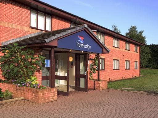 |
| View entry for Travelodge Kettering on Bed Map |
Gordon House - Kettering
| Gordon House - Kettering |
| Distance in Km 3.80 |
 |
| View entry for Gordon House - Kettering on Bed Map |
4 bedroom Kettering town house
| 4 bedroom Kettering town house |
| Distance in Km 3.90 |
 |
| View entry for 4 bedroom Kettering town house on Bed Map |
Rushton Hall Hotel and Spa
| Rushton Hall Hotel and Spa |
| Distance in Km 3.90 |
 |
| View entry for Rushton Hall Hotel and Spa on Bed Map |
Is a Hotel Missing?
Let us know the Name, Address and Postcode and we’ll add it to our listings.
Contact Us