
Search by Postcode
Map of the best Hotels near the RH18 5JL Postcode in Forest Row
We have searched high and low to find the best hotels near the RH18 5JL postcode in the historic county of East Sussex.
The RH18 5JL postcode is situated in Forest Row. We have found hotels nearby.
Use our easy to use hotel map or comprehensive accommodation listings to find the right RH18 5JL hotel for you.
| Zoom Level | Latitude | Longitude |
| 6 | 53.521968 | -2.164306 |
Hotel Deals for RH18 5JL Postcode in Forest Row
The Nearest Hospitals to RH18 5JL Postcode in Forest Row
| Hospital Name | Operator | Distance Km | Distance Mi. |
|---|---|---|---|
| Queen Victoria Hospital (East Grinstead) | Holtye Road, East Grinstead, West Sussex, RH19 3DZ | 7.56 | 4.70 |
| Crowborough War Memorial Hospital | Southview Road, Crowborough, East Sussex, TN6 1HG | 9.48 | 5.89 |
| Nuffield Health, Haywards Heath Hospital | Burrell Road, Haywards Heath, RH16 1UD | 11.40 | 7.08 |
| Burrswood Hospital | Burrswood, Groombridge, Tunbridge Wells, Kent, TN3 9PY | 11.60 | 7.21 |
Cheap Hotels near the RH18 5JL Postcode in Forest Row
The 10 nearest Budget hotels to the RH18 5JL Postcode offering economy accommodation
| Budget Hotel Name | Distance |
|---|---|
| 1:
Travelodge East Grinstead | 7.37 km (4.58 Miles) |
| 2:
Premier Inn East Grinstead | 10.56 km (6.56 Miles) |
| 3:
Premier Inn Haywards Heath | 16.00 km (9.94 Miles) |
| 4:
Premier Inn London Gatwick Airport East - Balcombe Road | 20.78 km (12.91 Miles) |
| 5:
Premier Inn Lewes Town Centre | 21.80 km (13.55 Miles) |
The Nearest Airports to RH18 5JL Postcode in Forest Row
| Airport Name | Distance Km | Distance Mi. |
|---|---|---|
| London Gatwick Airport | 16.31 | 10.13 |
| Biggin Hill Airport | 29.26 | 18.18 |
| Shoreham Brighton City Airport | 34.32 | 21.33 |
The Nearest Stations to RH18 5JL Postcode in Forest Row
| Station Name | Operator | Distance Km | Distance Mi. |
|---|---|---|---|
| East Grinstead | Govia Thameslink Railway | 7.00 | 4.35 |
| Dormans | Govia Thameslink Railway | 9.82 | 6.10 |
| Ashurst | Govia Thameslink Railway | 11.07 | 6.88 |
Places to Stay near the RH18 5JL Postcode
Roebuck by Greene King Inns
| Roebuck by Greene King Inns |
| Distance in Km 0.05 |
 |
| View entry for Roebuck by Greene King Inns on Bed Map |
Ashdown Park Hotel
| Ashdown Park Hotel |
| Distance in Km 1.81 |
 |
| View entry for Ashdown Park Hotel on Bed Map |
Twyford Farm B&B
| Twyford Farm B&B |
| Distance in Km 2.43 |
 |
| View entry for Twyford Farm B&B on Bed Map |
Spring Meadow
| Spring Meadow |
| Distance in Km 2.60 |
 |
| View entry for Spring Meadow on Bed Map |
Chequers Inn Hotel
| Chequers Inn Hotel |
| Distance in Km 3.44 |
 |
| View entry for Chequers Inn Hotel on Bed Map |
Brambletye Hotel
| Brambletye Hotel |
| Distance in Km 3.46 |
 |
| View entry for Brambletye Hotel on Bed Map |
Masketts Barn
| Masketts Barn |
| Distance in Km 4.02 |
 |
| View entry for Masketts Barn on Bed Map |
Moaps Farm Bed and Breakfast
| Moaps Farm Bed and Breakfast |
| Distance in Km 5.83 |
 |
| View entry for Moaps Farm Bed and Breakfast on Bed Map |
La Gallina
| La Gallina |
| Distance in Km 6.25 |
 |
| View entry for La Gallina on Bed Map |
The Pump House
| The Pump House |
| Distance in Km 6.64 |
 |
| View entry for The Pump House on Bed Map |
Calm Holiday Home in Hartfield Kent amidst Ashdown forest
| Calm Holiday Home in Hartfield Kent amidst Ashdown forest |
| Distance in Km 6.64 |
 |
| View entry for Calm Holiday Home in Hartfield Kent amidst Ashdown forest on Bed Map |
Gothic House @ CJ's
| Gothic House @ CJ's |
| Distance in Km 6.94 |
 |
| View entry for Gothic House @ CJ's on Bed Map |
Gothic House
| Gothic House |
| Distance in Km 6.95 |
 |
| View entry for Gothic House on Bed Map |
Romany
| Romany |
| Distance in Km 7.01 |
 |
| View entry for Romany on Bed Map |
Silver
| Silver |
| Distance in Km 7.01 |
 |
| View entry for Silver on Bed Map |
Tiger
| Tiger |
| Distance in Km 7.01 |
 |
| View entry for Tiger on Bed Map |
Honey Meadow Cottage
| Honey Meadow Cottage |
| Distance in Km 7.08 |
 |
| View entry for Honey Meadow Cottage on Bed Map |
Travelodge East Grinstead
| Travelodge East Grinstead |
| Distance in Km 7.37 |
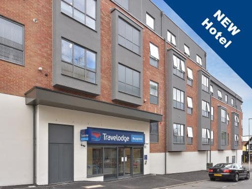 |
| View entry for Travelodge East Grinstead on Bed Map |
Is a Hotel Missing?
Let us know the Name, Address and Postcode and we’ll add it to our listings.
Contact Us